 NS Maritime
Request a service
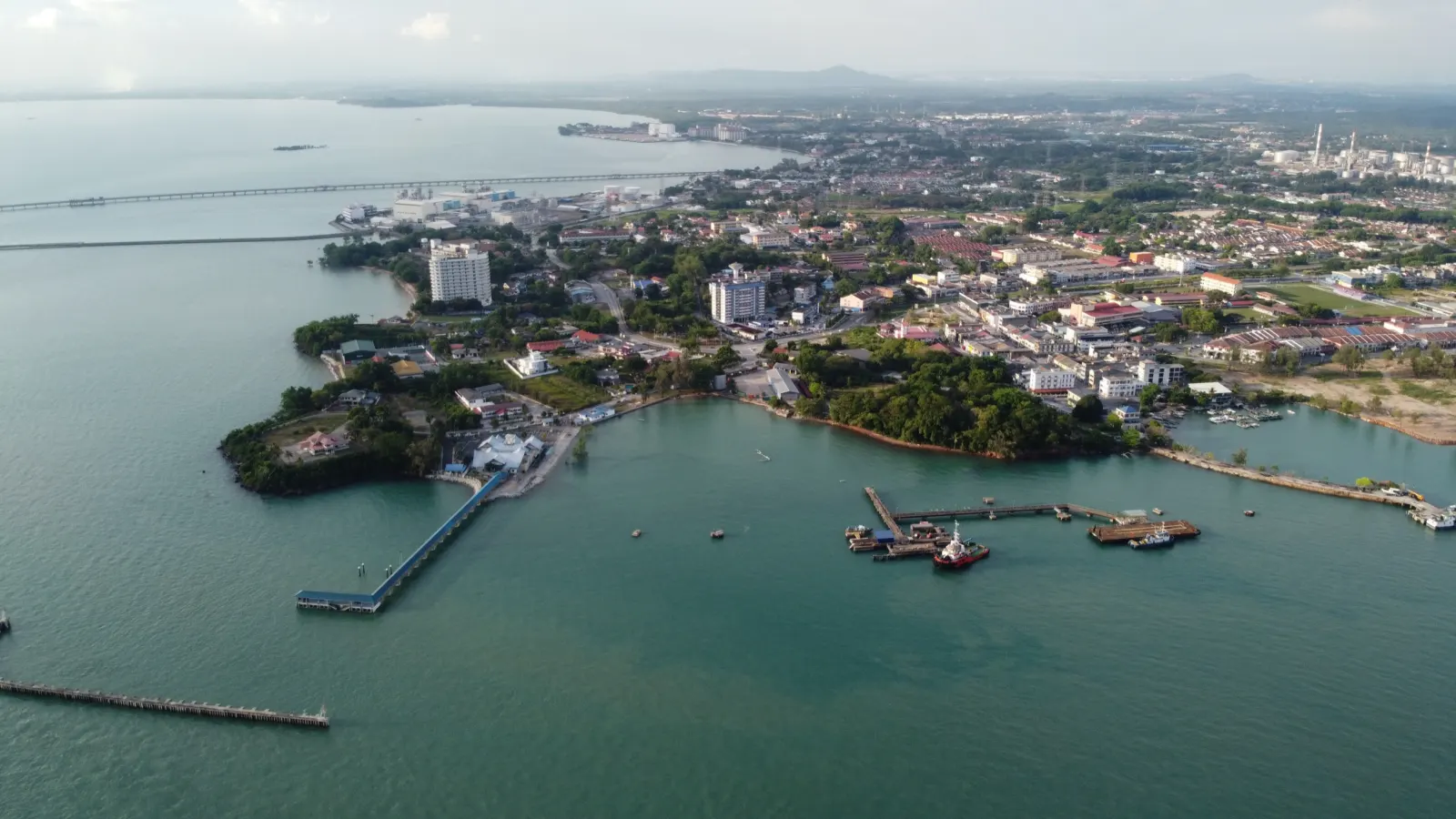
02°31′N 101°48′E
Home/Port Info
Port Dickson port information
Port details and facilities for vessels calling at Port Dickson, taken from the Marine Department and the facility operators.
Where we are
Port Dickson is in Negeri Sembilan and comes under the Central Region of the Marine Department of Malaysia. The department issues the Port Dickson port circulars from its marine office in the town.
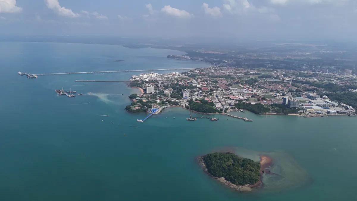

Facilities
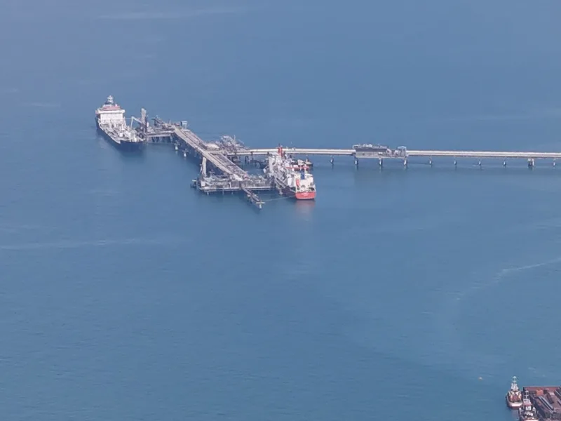
HRC terminal
Refinery jetty with three berths at the Hengyuan refinery in Port Dickson. The refinery ships products by sea to Sabah and Sarawak and exports propylene, light naphtha and part of its LPG.
Operator: Hengyuan Refining Company Berhad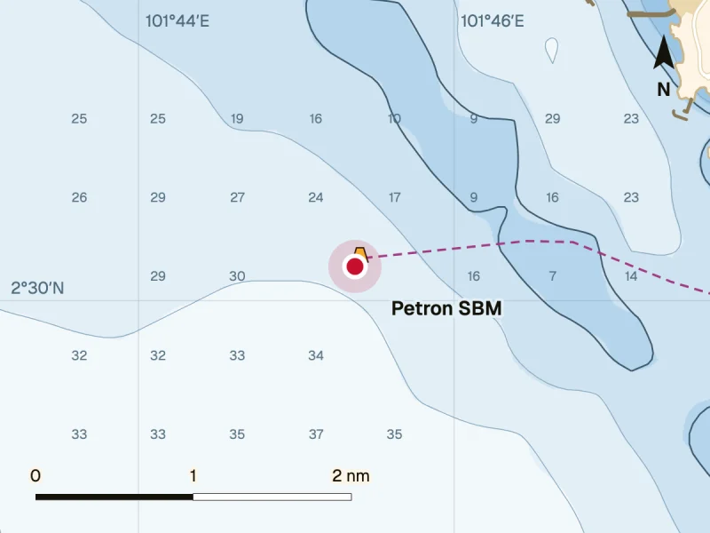
Petron SBM
Single buoy mooring linked to the Petron refinery by a subsea pipeline, in service since 2021 so the refinery can take larger vessels. Position 02°30.216′N 101°45.372′E. The refinery imports its crude, mostly light low sulphur grades, and has a crude distillation capacity of 88,000 barrels a day.
Owner: Petron Malaysia Refining & Marketing Berhad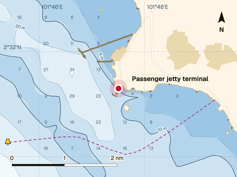
CIQ
Customs and Immigration have offices at the Port Dickson passenger jetty terminal, alongside the Marine Department, the health office and the Department of Agriculture.
Agencies: Royal Malaysian Customs Department, Immigration Department of Malaysia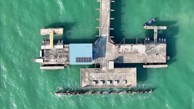
Port Dickson passenger jetty
Jeti Penumpang Port Dickson. The terminal is owned and licensed by the Marine Department of Malaysia.
Operator: NS MaritimeNSC jetty
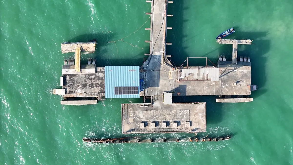
NS Corporation's jetty in Port Dickson, first built in the 1890s. A berth for company vessels and registered boat operators, with access for authorised people only.
Operator: NS Maritime, on lease from NS Corporation since August 2024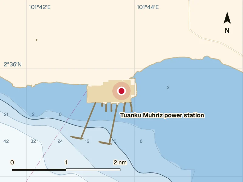
Tuanku Muhriz power station jetty
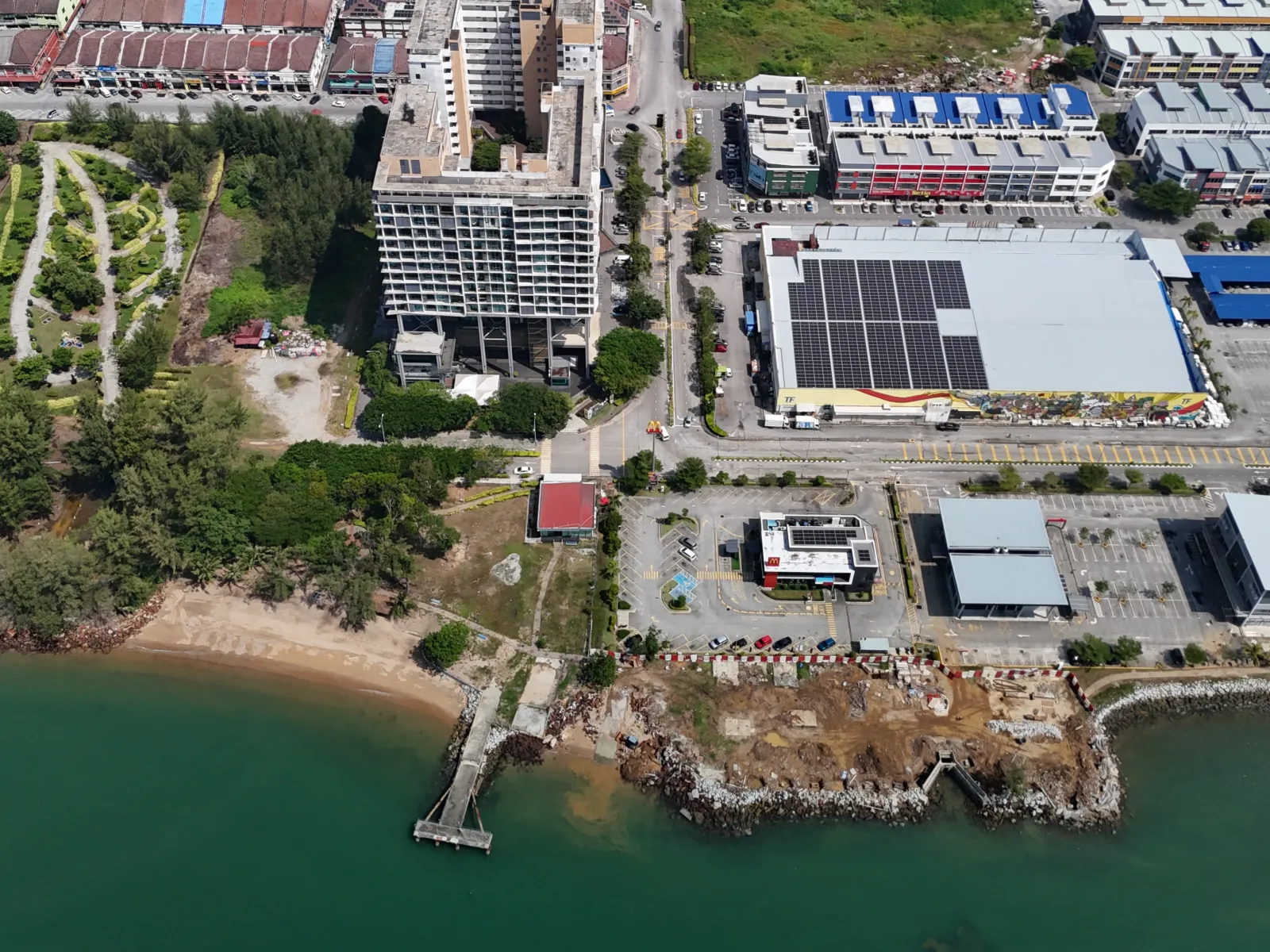
Coal jetty of TNB's Tuanku Muhriz power station, a 2,000 MW coal fired station at Mukim Jimah, Port Dickson. The jetty takes large capesize bulk carriers and received its first coal ship in mid 2019. Its construction was approved by the Marine Department and the Department of Environment.
Licensee: Jimah East Power Sdn Bhd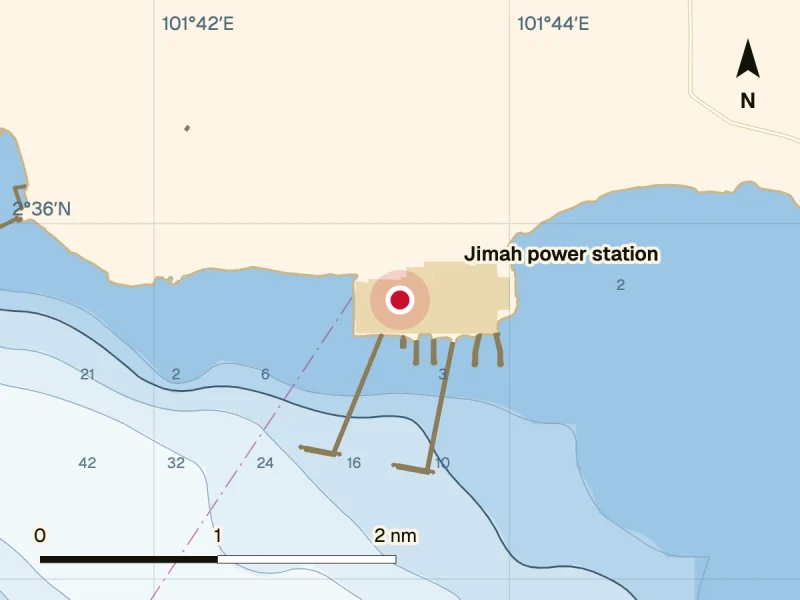
Jimah power station
Coal fired power station with a licensed capacity of 1,400 MW at Mukim Jimah, Port Dickson.
Licensee: Jimah Energy Ventures Sdn Bhd
Location charts show approximate positions. Depths are indicative. Not for navigation.
Port limits
The Marine Department of Malaysia describes the Port Dickson port limit as the area enclosed by a line from a marker board on Tanjong Kemuning to the buoy that marks the west channel between Pulau Arang Arang and the mainland, 4¾ cables on a bearing of 248° 30′ from the Pulau Arang Arang lighthouse. From the buoy the line runs due east until it meets a line drawn true south through a second marker board on the foreshore near the first mile of Coast Road, and then follows the coast back to Tanjong Kemuning.
This is the description published on the department’s port limits page. Please confirm the current limit with the Port Dickson marine office.
Page 2 of the same PDF is a chart, Batas Pelabuhan Port Dickson, which prints two positions: 02°30′04″N 101°42′35″E and 02°12′20″N 102°04′24″E. The chart on this page joins them with a dashed line marked Port limit.
- Port Dickson port limit (opens in a new tab) The description (PDF) from the Marine Department of Malaysia.
- Port limits of Malaysian ports (opens in a new tab) The department’s page of port limits, by region and state.
Sailing info
Official sources for tides and port notices at Port Dickson.
- Tide predictions (opens in a new tab) Tide times and heights for Port Dickson and other stations in Malaysia, from the National Hydrographic Centre (Pusat Hidrografi Nasional).
- Port circulars (opens in a new tab) Port circulars from the Marine Department of Malaysia. Those for Port Dickson are listed under Wilayah Tengah (Central Region).
- Guide to Port Entry Step by step guide for ships calling at Port Dickson, with a PDF to download.
Port notices
Recent Port Dickson port circulars from the Marine Department of Malaysia. List checked on 3 November 2026.
- No. 59/2026, 29 October 2026 (opens in a new tab) Survey and sampling work on a historic ship in Port Dickson waters, 14 to 19 November 2026.
- No. 57/2026, 29 October 2026 (opens in a new tab) Visual inspection of the Hengyuan Refining Company single buoy mooring, 29 October to 2 November 2026.
- No. 56/2026, 27 October 2026 (opens in a new tab) Repair and restoration of the ‘Berth 1’ jetty owned by Hengyuan Refining Company, 23 to 30 October 2026.
- No. 55/2026, 27 October 2026 (opens in a new tab) Works for the Petron refinery jetty replacement project within the Port Dickson port limit, 26 October to 31 December 2026.
- No. 54/2026, 23 October 2026 (opens in a new tab) Water sports for National Sports Day 2026 at Pantai Batu 1, Port Dickson, on 24 October 2026.
For every circular, see the full list of port circulars (opens in a new tab) under Wilayah Tengah.
Charts and weather
Official charts, notices to mariners and marine forecasts for the waters off Port Dickson.
- Chart MAL 5239 (opens in a new tab) Sekitar Perairan Port Dickson (waters around Port Dickson), scale 1:30,000, latest edition 31 December 2020, from the National Hydrographic Centre (Pusat Hidrografi Nasional).
- Notices to mariners (opens in a new tab) Monthly and annual Malaysian notices to mariners from the National Hydrographic Centre.
- Marine forecast for Negeri Sembilan waters (opens in a new tab) Weather, wind and wave height for the coming days, from the Malaysian Meteorological Department (MetMalaysia).
- Marine forecast for shipping (opens in a new tab) MetMalaysia forecasts by shipping area, including the Northern and Southern Straits of Melaka.
Port details
- Port
- Port Dickson, Negeri Sembilan, Malaysia
- Port authority
- Marine Department of Malaysia (Jabatan Laut Malaysia), Central Region. Port Dickson marine office, Jalan Raja Aman Shah, 71000 Port Dickson, +60 6-647 7993, ppdks@marine.gov.my
- Port operator
- NS Maritime Sdn Bhd, a joint venture of NS Corporation and Don Maritime Sdn Bhd
- Lay up points
- Two lay up points off Port Dickson, approved by Jabatan Laut Malaysia (Central Region) for NS Maritime. See Lay up.
NSC jetty particulars
- Location
- Port Dickson, Negeri Sembilan. The former Port Dickson railway jetty.
- First built
- 1890s
- Owner
- NS Corporation
- Operator
- NS Maritime Sdn Bhd, since August 2024
- Structure
- Fixed jetty with a reinforced concrete deck on piles
- Size
- 182.9 m long, with a 46 m jetty face. Site area about 5,268 m².
- Lighting
- 18 solar powered lights for night work
- Users
- Company vessels and approved, registered boat operators
- Access
- Restricted to authorised people, vessels and registered operators
Safety and emergency
NS Maritime keeps oil spill response, fire fighting and rescue cover on standby for the terminals, anchorages and jetties of Port Dickson. See OSR, fire fighting and rescue.
Contact numbers below are from Maritim Malaysia’s website.
- Maritime search and rescue
- The Malaysian Maritime Enforcement Agency (Maritim Malaysia) carries out maritime search and rescue and enforcement in the Malaysian Maritime Zone.
mmea.gov.my (opens in a new tab) - Maritim Malaysia, Melaka and Negeri Sembilan
- State headquarters, Kuala Linggi, 78200 Alor Gajah, Melaka, +60 6-387 6730
- Maritim Malaysia hotline
- National hotline, +60 3-8943 4001
- Port authority
- Marine Department of Malaysia, Port Dickson marine office, +60 6-647 7993